

Free Radical Enzymes and Photocatalyst
Author(s)
Kuo-En Ching & Ruey-Juin RauBiography
Prof. Ching is currently an associate professor in the Department of Geomatics at National Cheng Kung University (NCKU) in Tainan, Taiwan. He works on seismic hazard assessment and mud diapirism using geodetic data. Prof. Rau is a professor in the Department of Earth Sciences at National Cheng Kung University.
Academy/University/Organization
National Cheng Kung University-
TAGS
-
Share this article
You are free to share this article under the Attribution 4.0 International license
- NATURAL SCIENCES
- Text & Image
- July 19,2019
Mud diapirs (MDs) and mud volcanoes (MVs) are distributed worldwide at the convergent plate margins. However, the role of MDs and MVs in the development of accretionary prisms and their implications for seismic hazard assessment are usually ignored. The ongoing upward motion of inland MD at the Wandang MV in SW Taiwan has been evidenced by the increase in absolute gravity measurements at a rate of 4.58 μGal/yr. In addition, three isolated ultra-rapid surface deformation regions in SW Taiwan were also detected with extremely high line-of-sight velocity of more than 40 mm/yr using PS-InSAR techniques, GPS and leveling measurements. We propose that these three isolated HLVRs are also ongoing active inland mud diapirs. The overpressured sediments and fluid are squeezed and pushed upward due to the tectonic compression. Because these inland mud diapirs are bounded by active faults, the materials are also extruded toward the free boundaries along the channel constructed by these faults. In other words, the ultra-rapid stain rates may be mainly caused by the mud diapirism-induced lateral extrusion. The seismic hazard in SW Taiwan therefore needs to be re-evaluated by eliminating the inelastic deformation caused by the mud diapirism.
Mud diapirs (MDs) and mud volcanoes (MVs) are distributed worldwide mainly along the accretionary wedges (e.g., Mediterranean Ridge) or back-arc basins (e.g., Black Sea Abyssal Plane) of the convergent plate margins. Although the MDs and MVs are located in the tectonic environment where the fluid-rich thick sediment is accumulated at the high lateral tectonic compression rates and abnormally high formation pressure, buoyancy has been proposed as the major mechanism causing the vertical mud diapirism; this idea comes from the generation of salt diapirs. In addition, the inland MDs are no longer active, which is also proposed in previous studies. Therefore, the role of MDs and MVs in the development of accretionary prisms and their implications for seismic hazard assessment are usually ignored.
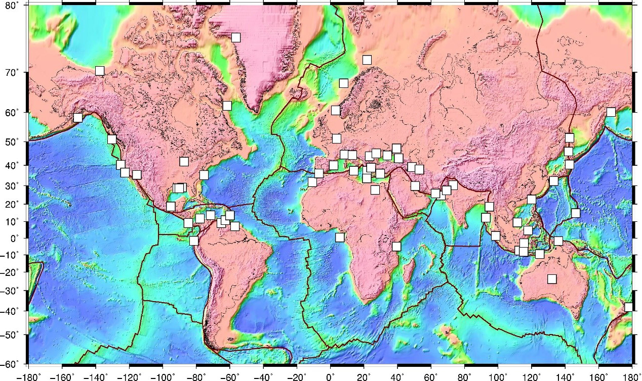
Distribution of mud diapirs in the world.
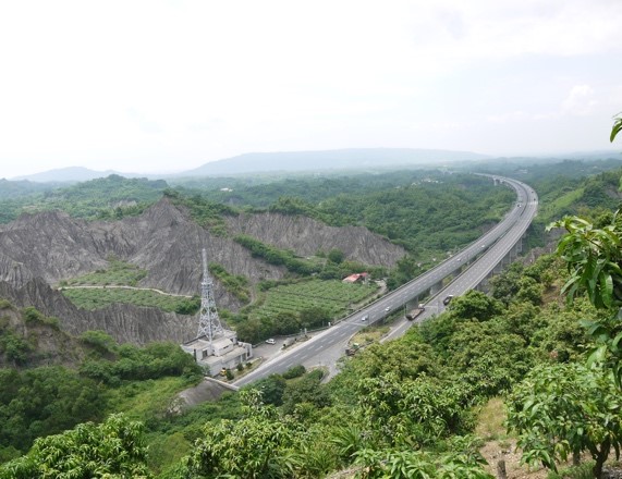
A series of MDs have been identified in the offshore area southwest of Taiwan. These offshore MDs have also been proposed to connect with the inland anticlines or tablelands, which are not active nowadays. The thrusting has therefore been suggested as the alternative mechanism to dominate the modern inland topography and the characteristics of inland crustal deformation. In other words, the high seismic hazard should be an issue of concern in SW Taiwan due to the observed ultra-rapid strain rates from GPS measurements. However, the numbers and frequencies of significant earthquakes in SW Taiwan are too few based on the earthquake catalogue. We have therefore started to consider the possibility of inelastic deformation caused by the MDs in SW Taiwan.
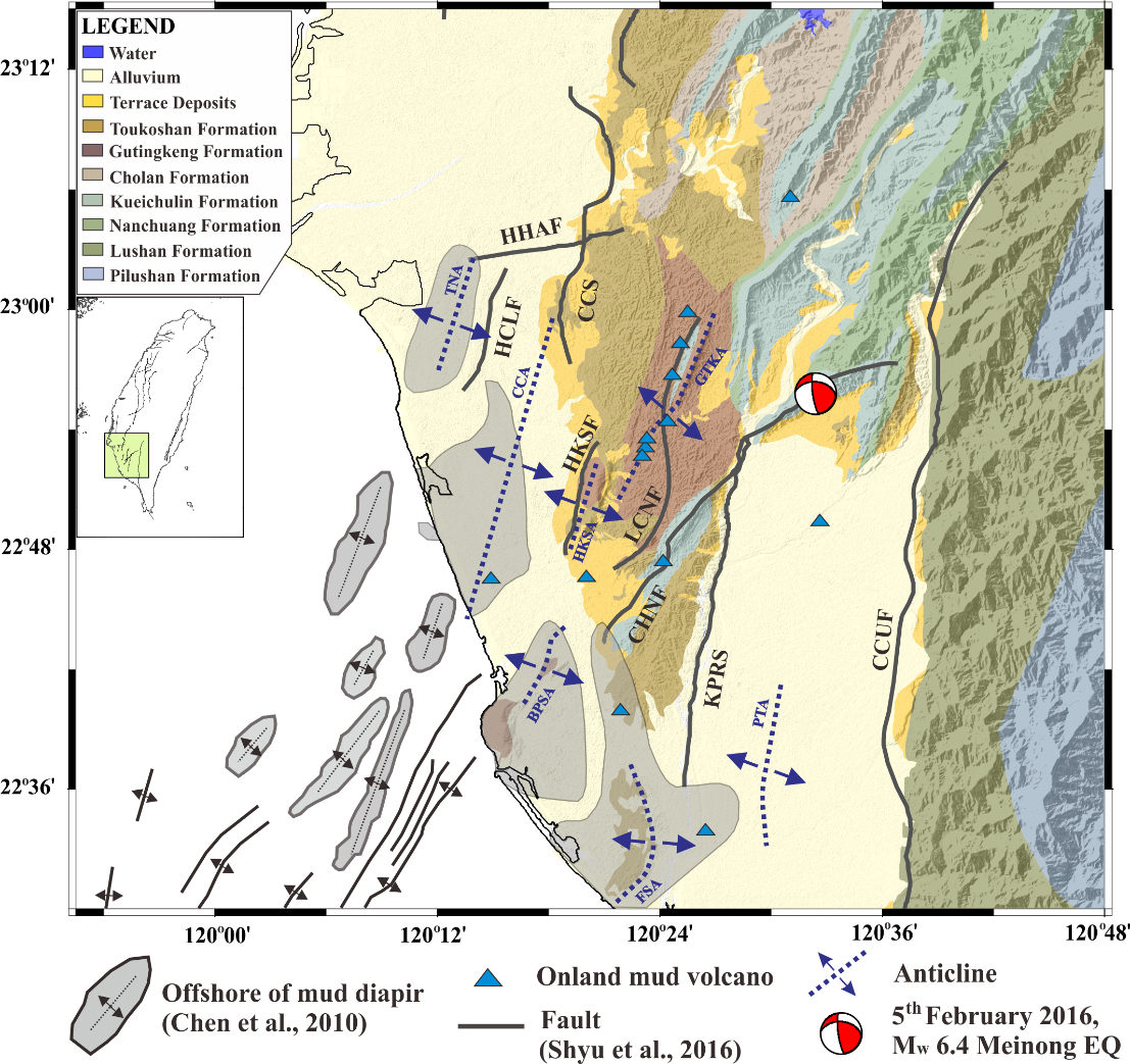
Geological map of SW Taiwan with the distribution of the mud diapir.
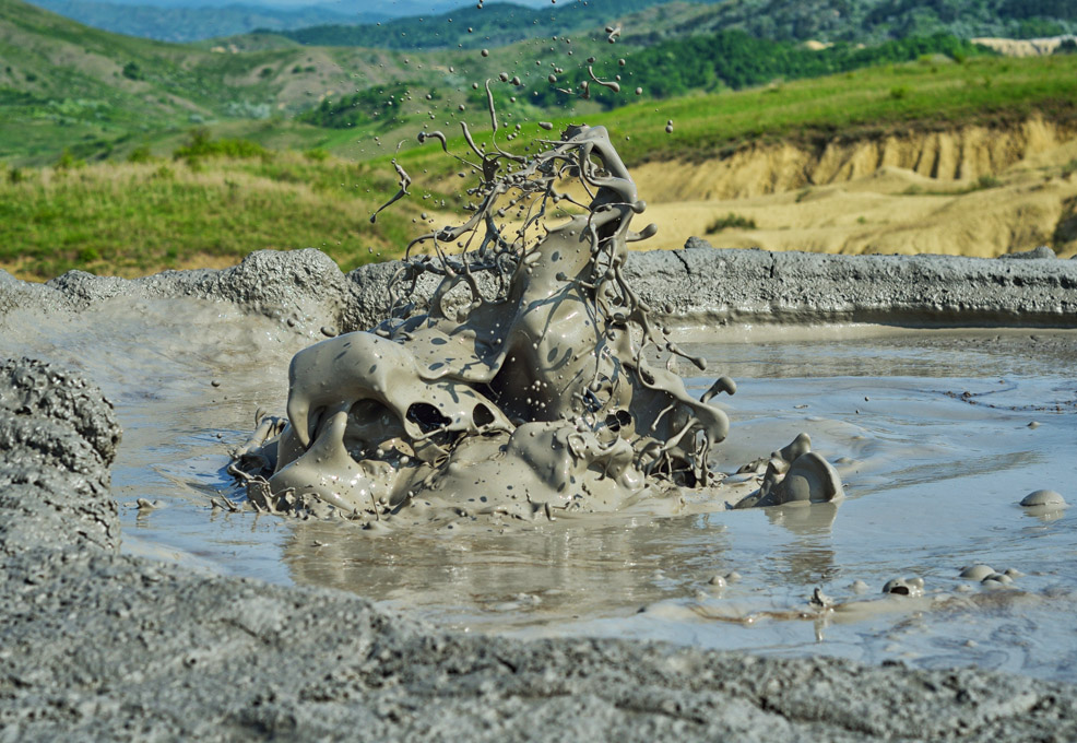
Is the inland mud diapir still active or not? The presence of MD in Wandan MV has been evidenced by seismic reflection data. An increase in absolute gravity measurements in the Wandan MV from 2015 to 2018 was detected as 4.58 μGal/yr, which is equivalent to land subsidence of 14.8 mm/yr. However, the observed land subsidence rate in this region is less than 5.0 mm/yr. After considering the stable variations in groundwater levels from three observational wells at distances of less than 1 km from the mud volcano, we propose that high density material is coming up from the deep source. Because only one strike-slip fault passes through this region, we therefore propose that this inland MD is still active. In addition, this sinistral strike-slip fault may be triggered by the upward motion of the mud diapirism based on the calculation of Coulomb stress change.
Further geodetic data from 2002 to 2016 and 17 ALOS SAR images between 2007 and 2011 were also collected to understand the rapid surface deformation in SW Taiwan. The geodetic data comprise 35 dual-frequency and 9 single-frequency continuous GPS stations, 65 campaign-mode GPS stations between 2002 and 2015 and 10 precise leveling routes between 2010 and 2016. All surface velocities are relative to the Chinese continental margin. From north to south, three regions (HLVRs) with extremely high line-of-sight velocity of more than 40 mm/yr were identified in SW Taiwan. Two of them (middle and southern HLVRs) are located within the central gap between two NE-SW-striking faults, which are the Lungchun fault (LCNF) to the west and the Chishan fault (CSNF) to the east. An uplift rate of ~80 mm/yr is detected at the middle HLVR. At the middle HLVR, a shortening rate of ~47 mm/yr and a left-lateral rate of ~6 mm/yr are shown across the LCNF, while an extension rate of ~32 mm/yr, and a right-lateral rate of ~11 mm/yr are represented across the CHNF. For the region south of the southern HLVR, a shortening rate of ~2 mm/yr and a right-lateral rate of ~10 mm/yr are shown across the LCNF, while a shortening rate of ~3 mm/yr, and a left-lateral rate of ~1 mm/yr are presented across the CHNF. Therefore, the middle HLVR is moving toward NE while the southern HLVR is moving toward SW.
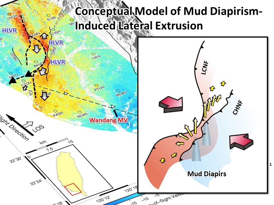
After comparing with the locations of mud diapirs and the seismic reflection profiles in SW Taiwan, we propose that these three isolated HLVRs are also ongoing active inland mud diapirs. The overpressured sediments and fluid are squeezed and pushed upward due to the tectonic compression. Because these inland mud diapirs are bounded by the active faults, the materials are also extruded toward the free boundaries along the channel constructed by these faults. In other words, the ultra-rapid stain rates may be mainly caused by the mud diapirism-induced lateral extrusion. The seismic hazard in SW Taiwan then needs to be re-evaluated by eliminating the inelastic deformation caused by the mud diapirism.
RELATED


STAY CONNECTED. SUBSCRIBE TO OUR NEWSLETTER.
Add your information below to receive daily updates.